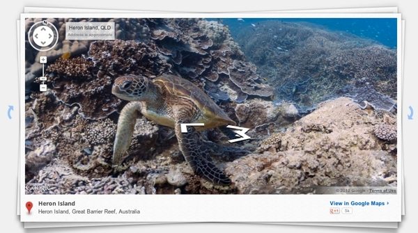
Google Maps takes a deep breath, now exploring the ocean floor
Anthony Garreffa / 12 years ago

Google have taken navigation is a totally new direction, where we’ve gone from normal maps, to Street Maps, to Google Earth, Google Sky Map, and now the Mountain View-based company are offering the first underwater panoramas through Google Maps.
Google partnered up with the Catlin Seaview Survery, a project focused on recording and unveiling the world’s oceans and reefs, where they’ll provide a “Sea View” experience in six of the ocean’s most beautiful coral reefs: Heron Island, Great Barrier Reef; Lady Elliot Island, Great Barrier Reef, Wilson Island, Great Barrier Reef; Apo Island, Philippines; Oahu, Hawaii: Hanauma Bay; Maui, Hawaii, Molokini Crater.
Google’s images were snapped with a specially designed underwater camera, dubbed the Catlin Seaview SVII, which snaps high-res, 360-degree pictures every three seconds while travelling underwater at speeds of around 2.5 miles per hour. The aim of the project is to give scientists across the world a tool they can use to monitor change in marine environments now, and in the future, all while giving the rest of us an amazing insight into the world’s oceans – exploring them from our electronic devices without getting wet.


